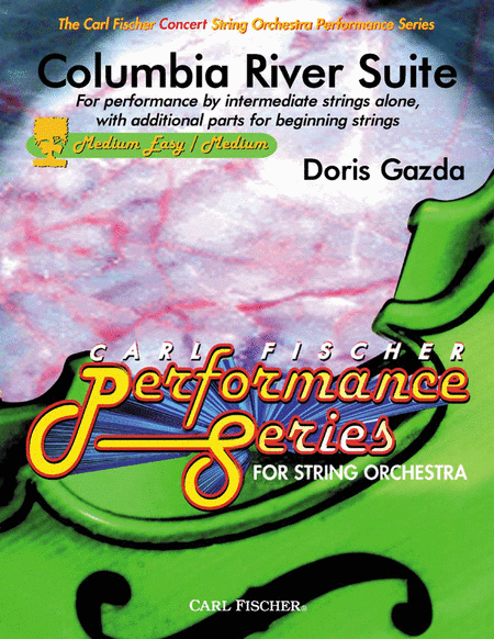
Columbia River Suite
For Performance by Intermediate Strings Alone with Additional Parts for Beginning Strings
-
Ships in 1 to 2 weeks
Details
Description
SKU: CF.CAS12
For Performance by Intermediate Strings Alone with Additional Parts for Beginning Strings. Composed by Doris Gazda. FS-SWS. Carl Fischer Concert String Orchestra Series. Classical. Score and Parts. With Standard notation. 48+64+64+16+20+40+16+16+12+12+12+8+12 pages. Carl Fischer Music #CAS12. Published by Carl Fischer Music (CF.CAS12).ISBN 9780825851834. UPC: 798408051839. 8.5 X 11 inches. Key: C minor.
The Columbia River, with a total length of 1,240 miles, starts in the Canadian Rockies, flows through the states of Washington and Oregon, and enters the Pacific Ocean at Astoria, Oregon. The river makes a thunderous crossing through the Cascade Mountains in a gorge that has become famous for its river-sporting events, as well as its series of eleven stair-step dams that provide hydroelectric power to the Pacific Northwest. The river had long been a major route of transportation for Native Americans when the American sea captain Robert Gray in 1792 explored its estuary and named it after his ship, Columbia. Because Gray was able to use the sextant* and other navigational tools that had been developed by Captain James Cook, the exact latitude and longitude of the mouth of the Columbia River were determined, and the approximate distance between the Atlantic and Pacific Oceans was established at 3,000 miles. Thomas Jefferson had proposed exploratory trips across the American continent several times during the 1790s, but not until he became the third president of the United States did he turn the expedition into a reality by getting Congress to appropriate funds for the journey and by appointing his secretary, Captain Meriwether Lewis, to lead it. Lewis spent many months studying navigation, botany, geology and geography and gathering supplies for the expedition. Of utmost importance was his ability to keep a journal account of the trip, including details about the land, the flora, the fauna and the Native Americans he would meet. Upon the outset of the journey Lewis invited William Clark, whom he had known while serving in the army, to join him on the difficult trek across the country. For Lewis and Clark, the mouth of the Columbia River was the final destination of their three-year odyssey, which started in 1803 and took them across the North American Continent to the Pacific Ocean. In 1806 they returned to St. Louis, where the townspeople bombarded them with questions, and the town leaders gave them a tremendous welcome. Several months later they traveled on to Washington, D.C., where they celebrated their great success with Thomas Jefferson at the White House. The Columbia River gained its reputation for size and grandeur through the reports and journals kept by Meriwether Lewis and William Clark, as they paddled and portaged their way to the Pacific Ocean. Soon after Lewis and Clark completed their trip, the Conestoga Wagons of the Oregon Trail followed the river and left their mark upon the landscape. The Columbia Rivers great waterfalls, the rivers proximity to the volcanic Mt. Hood and its richness in the history of the United States make it a central attraction in Western Oregon. *A sextant is an astronomical instrument used at sea to measure the altitudes of sun, moon and stars to determine latitude and longitude. String editing by Amy Rosen.
The Columbia River, with a total length of 1,240 miles, starts in the Canadian Rockies, flows through the states of Washington and Oregon, and enters the Pacific Ocean at Astoria, Oregon. The river makes a thunderous crossing through the Cascade Mountains in a gorge that has become famous for its river-sporting events, as well as its series of eleven stair-step dams that provide hydroelectric power to the Pacific Northwest. The river had long been a major route of transportation for Native Americans when the American sea captain Robert Gray in 1792 explored its estuary and named it after his ship, Columbia. Because Gray was able to use the sextant* and other navigational tools that had been developed by Captain James Cook, the exact latitude and longitude of the mouth of the Columbia River were determined, and the approximate distance between the Atlantic and Pacific Oceans was established at 3,000 miles. Thomas Jefferson had proposed exploratory trips across the American continent several times during the 1790s, but not until he became the third president of the United States did he turn the expedition into a reality by getting Congress to appropriate funds for the journey and by appointing his secretary, Captain Meriwether Lewis, to lead it. Lewis spent many months studying navigation, botany, geology and geography and gathering supplies for the expedition. Of utmost importance was his ability to keep a journal account of the trip, including details about the land, the flora, the fauna and the Native Americans he would meet. Upon the outset of the journey Lewis invited William Clark, whom he had known while serving in the army, to join him on the difficult trek across the country. For Lewis and Clark, the mouth of the Columbia River was the final destination of their three-year odyssey, which started in 1803 and took them across the North American Continent to the Pacific Ocean. In 1806 they returned to St. Louis, where the townspeople bombarded them with questions, and the town leaders gave them a tremendous welcome. Several months later they traveled on to Washington, D.C., where they celebrated their great success with Thomas Jefferson at the White House. The Columbia River gained its reputation for size and grandeur through the reports and journals kept by Meriwether Lewis and William Clark, as they paddled and portaged their way to the Pacific Ocean. Soon after Lewis and Clark completed their trip, the Conestoga Wagons of the Oregon Trail followed the river and left their mark upon the landscape. The Columbia Riveras great waterfalls, the riveras proximity to the volcanic Mt. Hood and its richness in the history of the United States make it a central attraction in Western Oregon. *A sextant is an astronomical instrument used at sea to measure the altitudes of sun, moon and stars to determine latitude and longitude. String editing by Amy Rosen.
The Columbia River, with a total length of 1,240 miles, starts in the Canadian Rockies, flows through the states of Washington and Oregon, and enters the Pacific Ocean at Astoria, Oregon. The river makes a thunderous crossing through the Cascade Mountains in a gorge that has become famous for its river-sporting events, as well as its series of eleven stair-step dams that provide hydroelectric power to the Pacific Northwest. The river had long been a major route of transportation for Native Americans when the American sea captain Robert Gray in 1792 explored its estuary and named it after his ship, Columbia. Because Gray was able to use the sextant* and other navigational tools that had been developed by Captain James Cook, the exact latitude and longitude of the mouth of the Columbia River were determined, and the approximate distance between the Atlantic and Pacific Oceans was established at 3,000 miles. Thomas Jefferson had proposed exploratory trips across the American continent several times during the 1790s, but not until he became the third president of the United States did he turn the expedition into a reality by getting Congress to appropriate funds for the journey and by appointing his secretary, Captain Meriwether Lewis, to lead it. Lewis spent many months studying navigation, botany, geology and geography and gathering supplies for the expedition. Of utmost importance was his ability to keep a journal account of the trip, including details about the land, the flora, the fauna and the Native Americans he would meet. Upon the outset of the journey Lewis invited William Clark, whom he had known while serving in the army, to join him on the difficult trek across the country. For Lewis and Clark, the mouth of the Columbia River was the final destination of their three-year odyssey, which started in 1803 and took them across the North American Continent to the Pacific Ocean. In 1806 they returned to St. Louis, where the townspeople bombarded them with questions, and the town leaders gave them a tremendous welcome. Several months later they traveled on to Washington, D.C., where they celebrated their great success with Thomas Jefferson at the White House. The Columbia River gained its reputation for size and grandeur through the reports and journals kept by Meriwether Lewis and William Clark, as they paddled and portaged their way to the Pacific Ocean. Soon after Lewis and Clark completed their trip, the Conestoga Wagons of the Oregon Trail followed the river and left their mark upon the landscape. The Columbia River's great waterfalls, the river's proximity to the volcanic Mt. Hood and its richness in the history of the United States make it a central attraction in Western Oregon. *A sextant is an astronomical instrument used at sea to measure the altitudes of sun, moon and stars to determine latitude and longitude. String editing by Amy Rosen.
The Columbia River, with a total length of 1,240 miles, starts in the Canadian Rockies, flows through the states of Washington and Oregon, and enters the Pacific Ocean at Astoria, Oregon. The river makes a thunderous crossing through the Cascade Mountains in a gorge that has become famous for its river-sporting events, as well as its series of eleven stair-step dams that provide hydroelectric power to the Pacific Northwest.The river had long been a major route of transportation for Native Americans when the American sea captain Robert Gray in 1792 explored its estuary and named it after his ship, Columbia. Because Gray was able to use the sextant* and other navigational tools that had been developed by Captain James Cook, the exact latitude and longitude of the mouth of the Columbia River were determined, and the approximate distance between the Atlantic and Pacific Oceans was established at 3,000 miles.Thomas Jefferson had proposed exploratory trips across the American continent several times during the 1790s, but not until he became the third president of the United States did he turn the expedition into a reality by getting Congress to appropriate funds for the journey and by appointing his secretary, Captain Meriwether Lewis, to lead it. Lewis spent many months studying navigation, botany, geology and geography and gathering supplies for the expedition. Of utmost importance was his ability to keep a journal account of the trip, including details about the land, the flora, the fauna and the Native Americans he would meet. Upon the outset of the journey Lewis invited William Clark, whom he had known while serving in the army, to join him on the difficult trek across the country.For Lewis and Clark, the mouth of the Columbia River was the final destination of their three-year odyssey, which started in 1803 and took them across the North American Continent to the Pacific Ocean. In 1806 they returned to St. Louis, where the townspeople bombarded them with questions, and the town leaders gave them a tremendous welcome. Several months later they traveled on to Washington, D.C., where they celebrated their great success with Thomas Jefferson at the White House. The Columbia River gained its reputation for size and grandeur through the reports and journals kept by Meriwether Lewis and William Clark, as they paddled and portaged their way to the Pacific Ocean. Soon after Lewis and Clark completed their trip, the Conestoga Wagons of the Oregon Trail followed the river andleft their mark upon the landscape. The Columbia River’s great waterfalls, the river’s proximity to the volcanic Mt. Hood and its richness in the history of the United States make it a central attraction in Western Oregon.*A sextant is an astronomical instrument used at sea to measure the altitudes of sun, moon and stars todetermine latitude and longitude.String editing by Amy Rosen.
Song List (3)
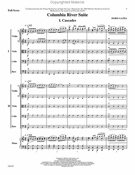
- Cascades
- Starlight on the Water
- Paddling to the Sea


 Share
Share